OLD TOWN GENOA HISTORY: SESTIERE DEL MOLO
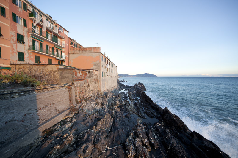
Sestiere del Molo is one of Genoa’s oldest districts. It includes the Castello and the Molo Vecchio (“Old Dock”) area, the structure that originated the ancient port. It is believed that the previous port was located at Ponticello, where the Torbido stream flowed into the sea, thus creating a natural inlet called Seno di Giano. In this area overlooking the sea, squares and alleys have been busy with activities connected with the port for a long time (go to the history of Genoa’s port).
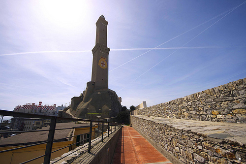
Mandraccio, the ancient port’s throbbing heart, was a protected landing place where for centuries all of the port’s activities were performed. Ships were loaded and unloaded here, the navy yard was here as well as the boathouse. During different centuries, it underwent continual adaptation, expansion and improvement works, while it was ultimately filled with earth in 1898 with 40,000 cubic metres of excavated material coming from road works in Via XX Settembre (the former Via Giulia). There are different versions about the origin of the name Mandraccio, which was already documented at the time of Justinian (6th century AD). Some claim that it derived from the mass of boats at the docks that had been built there, which looked like a herd (mandria is the equivalent Italian word, translator’s note). Other scholars believe that the name comes from Carthagininians or Arabs. Supposedly, the Genoese population used the term to indicate a protected sea arm (mare braccio in Italian, hence the name). Groups of houses stretched as far as Molo Vecchio, where a less important lighthouse had been placed along with the Lanterna (go to the Lighthouse’s history), which signalled the access to the port. It was defended, starting from the 16th century, from the huge Porta Siberia, designed by Galeazzo Alessi, and linked to the walls protecting the shore.
Molo and Mandraccio have not kept the same appearance as in the past. The whole area has undergone a restoration process which in the 1990s generated the Expò-Porto Antico area. However, the part of the centre that spreads as far as the sea still exists today. It is the Via del Molo area, with the church of S.Marco, and a tangle of tall, narrow buildings surrounded by a segment of the walls that end at Porta Siberia and overlook the shore. The alleys in this area are named after different professions. Grain stores can be found, which were replaced at a later stage by large silos between Ponte Parodi and Ponte dei Mille.
SOTTORIPA, ITALY’S OLDEST PUBLIC PORTICO
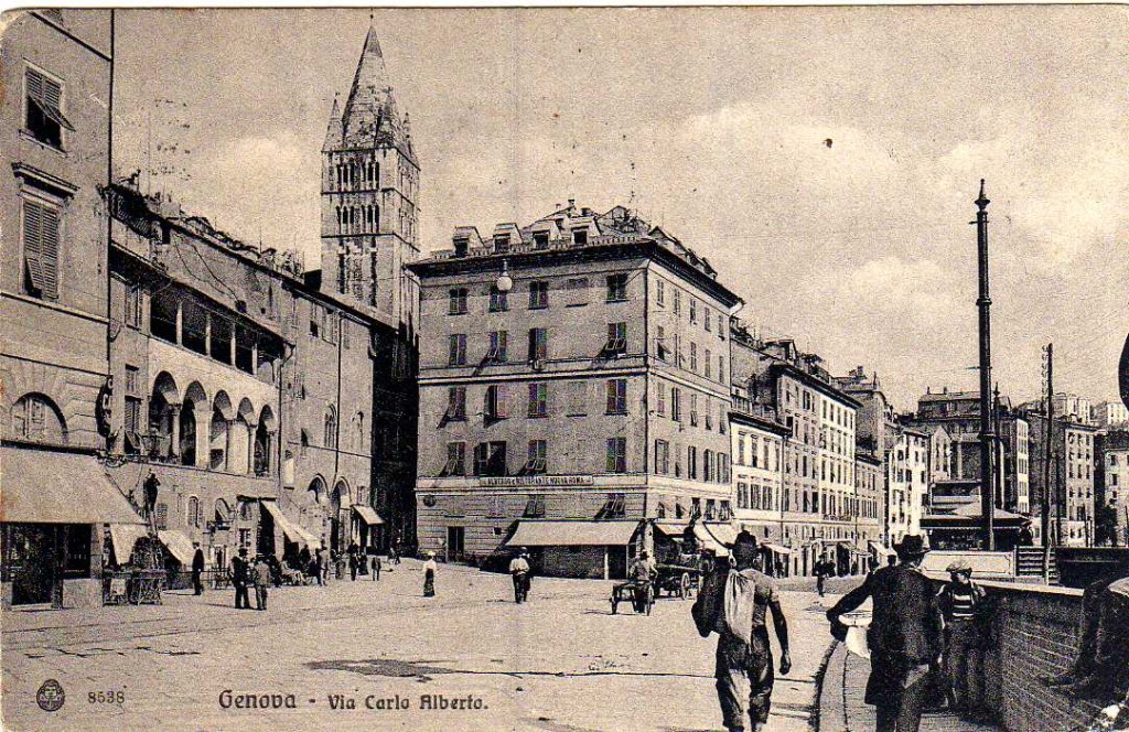
The Sottoripa portico is located between the sea and the city. This area was situated very close to the shore (ripa, in Italian). The sea would lap the shore and low banks protected the area from the waves by preventing water from reaching the streets, hence the name Sottoripa. The area began to be built in 1133. It is Italy’s oldest public portico. Small shops were placed next to one another along Sottoripa, which hosted all of the activities related to the port, while the retail shop was normally situated on the ground floor, and local people actually lived on the first floor, in accordance with the house building plans of that time. By decree, shop owners had to see to maintenance expenditures outside their shop. In return, they were given the right to live in the apartment above the shop while also being exonerated from taxes if they wished to widen their building. The Sottoripa building decree accurately indicates the methods and measures for building the portico. Extreme attention was paid to its architecture as Sottoripa would be the first area that could be seen by those arriving from sea. With these buildings, the area, which was already crowded because of the port, became one of the city’s busiest locations with plenty of commercial activities going on. Being covered, it also had the advantage that it provided shelter from bad weather conditions. After the construction of the sea walls in the 17th century, Sottoripa lost its natural connection to the sea, because it was separated from it. The walls became a barrier between the port and the city in Genoa’s history… A barrier which existed in different forms until the 1992 renovation.
Today, piazza Caricamento is situated in front of Sottoripa. This square was built by filling the seabed with earth in the 19th century, whilst old grains stores and the Padri del Comune building were also demolished. The area was given the current name in 1853, when a branch of the Turin-Genoa railway became the location where goods were loaded. The famous Palazzo S. Giorgio, located in the eastern part of the square, was built by architect-monk Oliviero in 1260 following the desire of Guglielmo Boccanegra, Captain of the People, so as to provide the Comune with its own headquarters. It was initially called Palazzo del Mare, but its name was changed to S.Giorgio when Banco di S.Giorgio moved there. This bank managed public debt and port incomes, as well as becoming the forerunner of all modern bank systems. St. Giorgio is one of the most important palaces in the Genoa’s history.
SAN LORENZO CATHEDRAL OF GENOA AND DOGE’S PALACE
The main road going down from the city to the port is Via S.Lorenzo. It starts from Piazza Matteotti and finishes in the small Piazza Raibetta. Its name is linked with that of the cathedral of the same name, which was built close to the walls in the 9th century. It was canonised in 1118, though lacking the facade, and made the cathedral because the area was protected by the walls and safer when compared to the older S.Siro church.
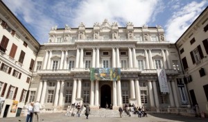
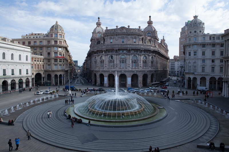
If you climb up via S.Lorenzo, you will reach Piazza Matteotti. Today it is less important than Piazza De Ferrari, however it used to have a pivotal role as this was the main access to Palazzo Ducale, the Doge’s palace. Built over pre-existing structures from the 13th century which belonged to the Doria and Fieschi families, it was defined as Genoa’s third wonder after the Cathedral and the Carignano church. The main construction area was purchased by the Comune in 1291. The Doge lived here and could not get out of the building except for celebrations during which he made his public appearance. Otherwise, visitors wishing to speak to him were hosted inside the palace. Dating back to the 14th century, the Torre Grimaldina, or Tower of the People, belongs to Palazzo Ducale. It was used as a prison – Jacopo Ruffini died here – which was meant to be part of the original Palazzo Fieschi, later absorbed by the Doge’s Palace. In Piazza Matteotti you will also find the Chiesa del Gesù, a late 16th century church built by the Society of Jesus over the pre-existing S.Ambrogio and Andrea church, where the Bishop of Milan took shelter during the Langobard invasion of his city in 568. In the 19th century, before the boom of cars and buses, Piazza Matteotti was the final stop of a horse-drawn omnibus – Genoa-Rivarolo was one of the lines starting from Matteotti – and also served as a streetcar passage. The people waiting for the omnibus stood at the side of the square, whilst streetcar passengers dashed on the rails in front of Palazzo Ducale towards Piazza De Ferrari, the final destination.
PIAZZA BANCHI E PIAZZA SAN MATTEO: GENOA HISTORY
Before Via S.Lorenzo was opened, from the Ripa the cathedral could be reached by climbing up the narrow Vico del Filo alley or through Piazza Banchi, the city’s old commercial heart as well as the location of one of the main markets, next to Porta di S.Pietro, which opened up among the walls which were later demolished. Citizens gathered there to listen to public announcements. In the 16th century, the square was also the venue for noblemen, according to a precise regulation: the old feudal nobility had to gather under the S.Luca portico, while the new nobility of merchants had to meet under the S.Pietro portico. The square hosts the S.Pietro in Banchi church, a peculiar building which stands on a ground floor occupied by shops, and the famous Loggia della Mercanzia, built at the end of the 16th century and used for buying and selling. Later on it became the headquarters of the Italian commodity exchange until the beginning of the 20th century, when it relocated to De Ferrari. Building the Loggia was part of a wider restoration of the square. At that time, only the requalification plan of Strada Nuova (go to the historical insight) was bigger than the refurbishment of the square. The new facades and its overall appearance, still visible today, provided the square with a monumental appearance which reflected the pivotal role that the piazza had had for centuries. In 1864, because of its proximity to the shore, Banchi was seriously damaged by bombs shot by the French fleet which attacked Genoa.
Moving from Piazza Banchi to the modern centre, the division line between Molo and Maddalena goes along Via Orefici, where goldsmiths used to have their shops. It crosses Campetto and reaches De Ferrari through Salita S.Matteo.
Piazza S.Matteo was the heart of the area occupied by the Doria family. It was completed in the middle of the 13th century following Lamba Doria’s decision and hosted several family palaces and the S.Matteo church. This was considered as the Doria family’s private “borough”: although several alleys surround it, they never cross it. The buildings, church and entire square are still perfectly preserved – their restoration was completed in the 1950s so as to give them their 13the century look again – and the image of the Doria family’s power comes across clearly. In the Middle Ages they led the Ghibelline faction and competed with the Fieschi family – the Guelph point of reference – for a dominant role in the city.
SARZANO HILL, SANTA MARIA DI CASTELLO
As already stated, the Molo area, the city’s oldest nucleus, was located on the Sarzano hill, also known as Castello. The first settlement dates back to Roman times as demonstrated by the plan structure and archaelogical discoveries proving that the area was inhabited in the 3rd century BC. In several buildings there are pre-existing elements which can be attributed to that time, whereas different layers show strengthening structures dating back to even before the Roman age. Castello hosted the castrum with three towers. It was the defensive centre and stronghold of Genoa’s primitive settlement, and for a long time it was printed on Genoa’s gold coins. When Langobard king Rothari conquered the city in 650, he organised and strengthened the castrum; it seems that some years later his son Aripert erected the city’s first temple devoted to Holy Mary inside the Castello walls. It corresponded to the area of the sacristy of the current church. Starting from this primary nucleus the S.Maria di Castello complex was completed. Built in the early 12th century, it is another example of monuments in the city centre where remains from the Roman architecture have been used. It is here, ages before the construction of Palazzo S.Giorgio, that the Consuls administered justice, following the widespread habit of dealing with delicate business close to the sanctuary. The bishop’s palace from the 9th and 10th century was built in the same location. This shows the importance of its favourable position at the top of the hill, as the headquarters of the military and religious power were based here. At that time, the people coming from sea could spot the church on the hilltop, which overlooked the surrounding area. Not far from there, the S.Maria in Passione church was destroyed by World War II shelling and never rebuilt again. On October 22, 1942 air raids seriously damaged the Castello hill, which was almost levelled on September 4, 1944. Like S.Maria in Castello, even this building presents layers attesting pre-existing Pre-Roman, Roman and Byzantine construction. Later additions were made during the Langobard era, the Middle Ages and Renaissance. According to certain scholars, the presence of huge stone blocks at the foundation of certain walls should be attributed to the remains of the ancient Castello walls. Palazzo and Torre degli Embriaci are located in the descending part of the hill, and Embriaci is the only tower perfectly preserved in the city, as it survived the law decreeing that private towers should be cut in 1196. It was also stronger than domestic fights and shelling to which Genoa was exposed for centuries until World War II.
PIAZZA SARZANO
Piazza Sarzano, whose name seems to derive from Arx Jani, i.e. the fortress of Giano, the city’s protector, is the original settlement on the Castello hill, and Giustiniani suggested that it was in this place that shrouds – hemp rods used on ships – were produced. Piazza Sarzano was also a meeting place and parliament for Genoese people: it can be defined as the city’s agora. It was here that Genoa’s citizens vowed to be loyal to emperor Henry VII and here again, in 1490, tournaments were held to celebrate Agostino Adorno’s heir’s birth. Sarzano hosts a fountain inside the six-column temple which was completed in the 17th century. At its top, the Giano Bifronte bust stands out. It was made by Della Porta and moved to different fountains until reaching the current location. Today a copy is exhibited while the original version is kept at S.Agostino.
Claudia Baghino
Translated by Daniele Canepa

